began at the West Tensleep Lake trailhead, traversing a well-worn path for about 10 miles through glacial moraines (click to enlarge):
Wildflowers were thriving in the high altitude and provided colorful distraction from my burdensome backpack, loaded for three days alone in the back country:
This view toward the northeast, from the shores of Lake Helen, provides the first glimpse of the west ridge route to the summit of Cloud Peak (13,167 ft):
I bivied a short distance away from this 40 ft waterfall for two nights, preparing my meals alongside the stream so that odors wouldn't draw bears to my camp:
I started toward the summit at around 8 am (a tad bit late), navigating a ~3 mile scramble/hike over seemingly relentless boulder fields, gaining more than 3,200 ft along the way. Here's a snap of the highest blooming plant (Parry's primrose) that I encountered on the west ridge:
I arrived at the lofty summit around 1 pm, taking the requisite self portrait. That's Glacier Lake, more than 1,800 ft below me, on the east side of the peak:
Another view from the summit shows numerous alpine lakes in a glacially-denuded basin to the north:
Pikas were everywhere in the boulders at mid to lower elevations, and provided near constant companionship on my solo hike:
On the final morning, during my hike out, I encountered two wary moose near Mistymoon Lake:
And here's the last picture I took, gazing back toward my now accomplished objective, as I left the magnificent wilderness:
Showing posts with label wyoming. Show all posts
Friday, August 26, 2011
Monday, August 22, 2011
Adventure beckons...
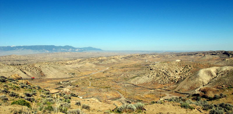
the minute you drive off the pavement east of Yellowtail Reservoir, Wyoming, following gravel roads with challenging 4WD upgrades. That's caving buddy DA in his Baja Bug leading the way into the northern Bighorn Mountains (click to enlarge):
Two old miner's cabins stand in the near distance, our "camp" for the previous week of caving and other explorations of the area, with the East and West Pryor Mountains looming beyond:
Pronghorn antelope spied our presence in this out-of-the-way place, never approaching closer than the high ridge overlooking our camp:
One of our activities involved surface survey for sinkholes in this exhumed karst terrain, but Devil Canyon plunges more than 900 feet from rim to river (Porcupine Creek), an effective geographic obstacle to exploring further north:
Defunct uranium mines perforate the landscape, where recent but feeble attempts have been made to close the entrances due to safety concerns:
We went rockhounding one afternoon, and nice specimens of dogtooth spar calcite were found in the mine dumps:
The nearly sheer walls in Bighorn Canyon show a solutioned zone in the Madison Limestone about 80 to 110 ft below the plateau surface, marking the stratigraphic zone where most caverns had been formed in this area. Note the boaters for scale:
Nearby, a pair of abandoned channels of the ancestral Bighorn River lie hundreds of feet above the present river level, and are appropriately named the "Natural Corrals:"
By the way, we ate quite well during our week in residence:
And every-other evening provided a photo-worthy sunset:
Two old miner's cabins stand in the near distance, our "camp" for the previous week of caving and other explorations of the area, with the East and West Pryor Mountains looming beyond:
Pronghorn antelope spied our presence in this out-of-the-way place, never approaching closer than the high ridge overlooking our camp:
One of our activities involved surface survey for sinkholes in this exhumed karst terrain, but Devil Canyon plunges more than 900 feet from rim to river (Porcupine Creek), an effective geographic obstacle to exploring further north:
Defunct uranium mines perforate the landscape, where recent but feeble attempts have been made to close the entrances due to safety concerns:
We went rockhounding one afternoon, and nice specimens of dogtooth spar calcite were found in the mine dumps:
The nearly sheer walls in Bighorn Canyon show a solutioned zone in the Madison Limestone about 80 to 110 ft below the plateau surface, marking the stratigraphic zone where most caverns had been formed in this area. Note the boaters for scale:
Nearby, a pair of abandoned channels of the ancestral Bighorn River lie hundreds of feet above the present river level, and are appropriately named the "Natural Corrals:"
By the way, we ate quite well during our week in residence:
And every-other evening provided a photo-worthy sunset:
Wednesday, August 17, 2011
Elk Basin oil field...
sits astride the Montana/Wyoming border in the northern Bighorn basin and is a breached doubly-plunging anticline (click to enlarge):
This geologic structure is the site of an actively operating oil field and is used as a three-day mapping exercise for students attending geology field camp at YBRA:
The historic field is no longer operated by Amoco, but it is still under production:
This geologic structure is the site of an actively operating oil field and is used as a three-day mapping exercise for students attending geology field camp at YBRA:
The historic field is no longer operated by Amoco, but it is still under production:
Thursday, August 11, 2011
Another summer road trip...
is about to commence, departing mid-morning tomorrow, consisting of a combination plate of geology, caving and climbing. Packing is underway.
I'll first visit the Yellowstone-Bighorn Research Association (YBRA) geology field station near Red Lodge, Montana. I attended the camp as an undergraduate student in 1978 and still consider it the best six weeks of my early training as a fledgling geologist. This time I'll be volunteering my time to making end-of-season repairs to the facility, including patching the cabins, replacing screens, painting, etc. Other alums will participate (Geogal and her husband will be there) and we'll be well fed by the kitchen staff for all our efforts. I can't wait to hear the camp's dinner bell ring again.
Then I'll proceed to the Bighorn Mountains where I'll meet long-time caving buddy DA to map a recent new discovery. I won't reveal the location, but the cave is in a remote and beautiful spot at the end of a gnarly 4WD road. More people have walked on the Moon than have visited this cavern.
Afterward, I plan to make a three-day solo dash to the summit of Cloud Peak (13,167 ft), the highest in the Bighorn range, and a goal of mine for some time. And finally, I'll boomerang back through Bozeman and visit Zegrahm Expeditions buddy MM (we sailed together last year across the Bering Sea). It will be a fun and active two weeks, and maybe I'll slip in a post now and then.
I'll first visit the Yellowstone-Bighorn Research Association (YBRA) geology field station near Red Lodge, Montana. I attended the camp as an undergraduate student in 1978 and still consider it the best six weeks of my early training as a fledgling geologist. This time I'll be volunteering my time to making end-of-season repairs to the facility, including patching the cabins, replacing screens, painting, etc. Other alums will participate (Geogal and her husband will be there) and we'll be well fed by the kitchen staff for all our efforts. I can't wait to hear the camp's dinner bell ring again.
Then I'll proceed to the Bighorn Mountains where I'll meet long-time caving buddy DA to map a recent new discovery. I won't reveal the location, but the cave is in a remote and beautiful spot at the end of a gnarly 4WD road. More people have walked on the Moon than have visited this cavern.
Afterward, I plan to make a three-day solo dash to the summit of Cloud Peak (13,167 ft), the highest in the Bighorn range, and a goal of mine for some time. And finally, I'll boomerang back through Bozeman and visit Zegrahm Expeditions buddy MM (we sailed together last year across the Bering Sea). It will be a fun and active two weeks, and maybe I'll slip in a post now and then.
Sunday, January 9, 2011
Pics from the past...
chronicling one of my climbs on Devils Tower in northeast Wyoming in 1988, a volcanic neck that rises 1,267 feet (386 m) above the Belle Fourche River (click to enlarge):
I was accompanied by former graduate student RR on this particular adventure, seen here on lead in the off-width Durrance Crack route, ranked as one of the Fifty Classic Climbs in North America:
NOTE: I am making it a personal project this year to digitize my vast color slide collection, conservatively estimated to be well more than 15,000 in number. I intend to methodically high grade the collection and slowly scan slide sets as I find the time. In addition, I will randomly and variously post some images that highlight some of my more interesting experiences on this blog of mine.
I was accompanied by former graduate student RR on this particular adventure, seen here on lead in the off-width Durrance Crack route, ranked as one of the Fifty Classic Climbs in North America:
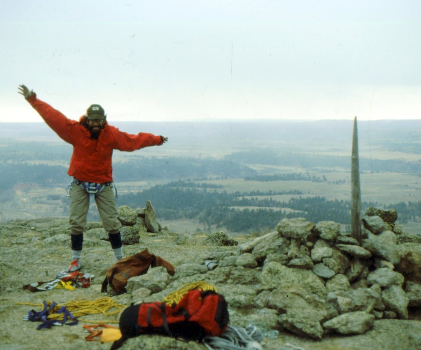
Here is the requisite hero shot on the summit during a break in the snow flurries that dogged us during the several hour climb:
I recall there were dozens of chipmunks running all over the summit while we ate our lunch. And here's another shot of me, on rappel on the south face descent route, zipping down the enormous phonolite porphyry columns:
NOTE: I am making it a personal project this year to digitize my vast color slide collection, conservatively estimated to be well more than 15,000 in number. I intend to methodically high grade the collection and slowly scan slide sets as I find the time. In addition, I will randomly and variously post some images that highlight some of my more interesting experiences on this blog of mine.
Friday, June 5, 2009
An image of Earth...
Image credit: Jacques Descloitres; MODIS team; NASA, 14 July 2004.
Subscribe to:
Posts (Atom)