Showing posts with label moab. Show all posts

Monday, December 26, 2011

This culvert is a portal...

to the eponymously named Culvert Canyon, found along the Potash Road near the Gold Bar campground on the Colorado River, and the focus of today's backcountry sojourn (click images to enlarge):
There are no maintained trails in the branching canyon system, and route finding is not trivial, but here's a reasonably accurate description that can guide you on your own adventure.  This sandstone spire stands as a prominent landmark in the upper part of the basin, and serves as a natural guidepost:
Climbing higher and through the pass containing the sandstone sentinel the ultimate goal of today's exploration is found a short distance beyond, Gold Bar Arch:
The opening is about 40 ft high and 50 ft wide, and provides a fantastic stony frame to the distant La Sal Mountains:
Here's a view after passing through the arch, towards the west:
Critical stats:  1.75 miles from the trail head with 1,100 feet of elevation gain.  One large rockfall heard.  Zero humans encountered.  Priceless.

Tuesday, February 1, 2011

An aerial tour of the Moab area...

was made with JC and former student DC in 2005.  We start with a look at the sandstone "Fins" on the east flank of the Salt Valley anticline in Arches National Park, north of the Devils Garden campground (click images to enlarge):
Flying south, here's a unique perspective of the iconic Delicate Arch standing in a wind-sculpted basin in the Entrada Sandstone:
The collapsed Salt Valley anticline in the center of Arches National Park contains the younger and bright green beds of the Brushy Basin Member of the Morrison Formation near the trailhead to Delicate Arch:
The steeply dipping strata in the Cache Valley graben provide a dramatic backdrop above the Sorrel River Ranch on the Colorado River:
We turn southwestward and zoom past Castleton Tower with Castle Valley and the Porcupine Rim in the background:
The flight line across downtown Moab provides a view northwest along the axis of the Spanish Valley anticline:
Saline brines from deep solution mining in the Paradox Formation are evaporated in large ponds at Potash:
Further south, Monument Basin, Junction Butte and Grand View Point mark the southern edge of the Island in the Sky District of Canyonlands National Park, and those are the laccolithic Henry Mountains looming in the distance:
The early morning flight resulted in long shadows at the confluence between the Green and Colorado Rivers:
"The Grabens" in the Needles District are a result of the fracturing and sliding of the Cedar Mesa Sandstone above the Paradox Formation, as the Colorado River erodes Cataract Canyon:
"The Loop" meander bend in the Colorado River upstream of the confluence shows curvilinear fractures that parallel the sinuous channel, suggesting lateral unloading during down-cutting:
The prominent White Rim Sandstone is exposed by an incised meander on the Green River at Turk's Head, the small but prominent butte inside the loop:
And here's a different perspective of Upheaval Dome with the Green River in the background:
Finally, we cross the Moab Fault where it is exposed in Bartlett Wash, juxtaposing the Entrada Sandstone (Jurassic; right) against darker Cretaceous-age units (left), with the La Sal Mountains in the distant haze.

Saturday, November 20, 2010

Manhunt in Moab...

is underway for a man who shot a ranger late Friday night.  Where are you, Anna Pigeon?

UPDATE:  Rifle found. The dude should just give it up.  He'll either get cliffed-out or have to swim the Colorado River.

UPDATED UPDATE:  Some images of the crime scene, and a bloody t-shirt found.

EVENING UPDATE:  Search for fugitive shooter scaled back for the night.  Overnight forecast calls for 38 °F and 60% chance of rain.

SUNDAY MORNING:  Search resumes.

MONDAY MORNING:  Suspect has been named and the search continues.

TUESDAY:  Search area narrows (with video).

28 NOV:  Moab ranger remains stabilized, search discontinued.  I believe the shooter is dead, hidden in a sandstone crevice, somewhere south of the potash mine.

Thursday, June 17, 2010

Matrimony Spring today...


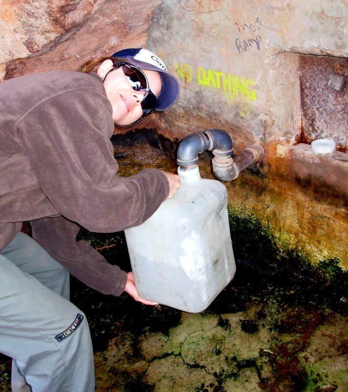
and as it was in the not too distant past:
You can see in the first image that the spring box and piping has been entirely removed, returning the spring to its natural state (click to enlarge). Someone has configured a bent metal trough to funnel a portion of the water stream into smaller water bottles, but filling a large canister is impossible. The second image features a former student, CR, during an EWU geology field trip to the area in 2007 (she's now a successful project manager for a mining company in Nevada).

Here's a related post about the recent changes to this historic site near Moab, Utah.

Thursday, June 3, 2010

Matrimony Spring...

near Moab, Utah is still accessible but will remain undeveloped: County council rejects plan to develop Matrimony Spring, votes to leave spring in ‘natural state’.

Previous related post.

Thursday, March 4, 2010

Matrimony Spring...

near Moab, Utah may be rehabilitated: County engineer says reopening Matrimony Spring would be costly, but may be possible.

I hope this works. The landmark spring should never have been closed in the first place, in my opinion.

Previous related post.

Thursday, September 3, 2009

Historic Matrimony Spring...

near Moab, Utah is undergoing additional water quality testing since it was closed as a public water source earlier this year, ostensibly due to the presence of coliform bacteria. At present, visitors to the well known spring will discover the old spring box and pipe outlet has been disassembled, and that it is no longer possible to acquire water at this site. Sad.

Rumor was if you drank from the spring you would be "wed" to the area, bound to return again, hence the name. Personal testimonial: I drank generously of this cool elixir as early as 1982, frequently ever since, and it has obviously worked its magic on me.